


In that case, pick checkpoints that will show up in your best field of view, 9:00 O-clock to 12:00 O-clockOriginally Posted by pilotgirlbuf

The part I bolded disturbs me a bit......high altitude = safe altitude, i dont want to get distracted and run into a cell tower lol. however i feel if i descend to the listed altitude on the sectional i wont have to worry about towers or obstructions.
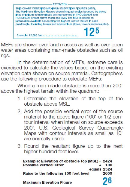
I assume you are referring to the Maximum Elevation Figures on the charts:
note how these relate to the Chart Legend
So far so good but what you need to respect is that these are derived from a calculation that may not give you and I the Safety that we would like!
From AOPA's explanation of chart symbols (LINK):
(I hope these come out OK, first time I have attached images here)
I have used MEF's in the past but always add another 100 to 200 feet onto them.

 Reply With Quote