-

Flight analysis software
I am working on a flight analysis software package. Primarily for my own use, I'm like to gauge the interest in such a thing to see if it's worth developing into something clean enough to offer as commercial software, probably with a price point somewhere around $50 or less. I've looked around but there doesn't seem to be much out there, except for programs aimed mainly at glider pilots (like GPLIGC, which is free but has a rather involved install) or high end programs aimed at professional flight testing. Mine is intended for the amateur pilot, to track flights and do basic performance measurements.
At this point, the program will:
- Read a .gpx or .kml file created by a GPS receiver
- Break the track file up into segments at each point where the aircraft stopped
- Display a list of flights, showing flight time and the airport names and IDs (from the FAA database)
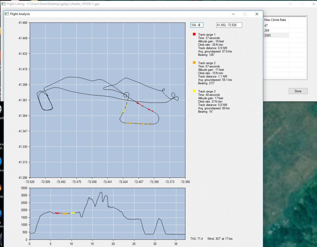
- Display a selected flight on a graph showing top (map) view and side (profile)
- Display the aircraft performance (speed, distance, rate of climb/sink) averaged over the selected segment(s)
- Calculate true airspeed and wind speed from three selected segments
- Any other useful features I haven't thought of?
I see this being valuable for testing of a new aircraft: Check rate of climb at different speeds to determine the best climb speed, calibrate your airspeed indicator, etc. The map view won't show an actual map or satellite view under the track; there are plenty of other programs that do that.
I'm currently using a non aviation Garmin handheld for testing; I don't know what file format other GPS receivers supply or how you get the track file from them; I would appreciate any input on that (or perhaps files for testing).
Thoughts?
 Posting Permissions
- You may not post new threads
- You may not post replies
- You may not post attachments
- You may not edit your posts
-
Forum Rules


 Reply With Quote