-
EAA AirVenture Grounds Map Correct road layout
-
I don't know what the point of this post was since it was offered without explanation. However, I'd certainly not base anything on that photo. That was taken before the new perimeter fence and road was put in. The grounds are very much different now.
-
Sorry about that FlyingRon,
The aerial 2011 AirVenture photo was just a bonus shot I uploaded to show what it looks like during the convention.
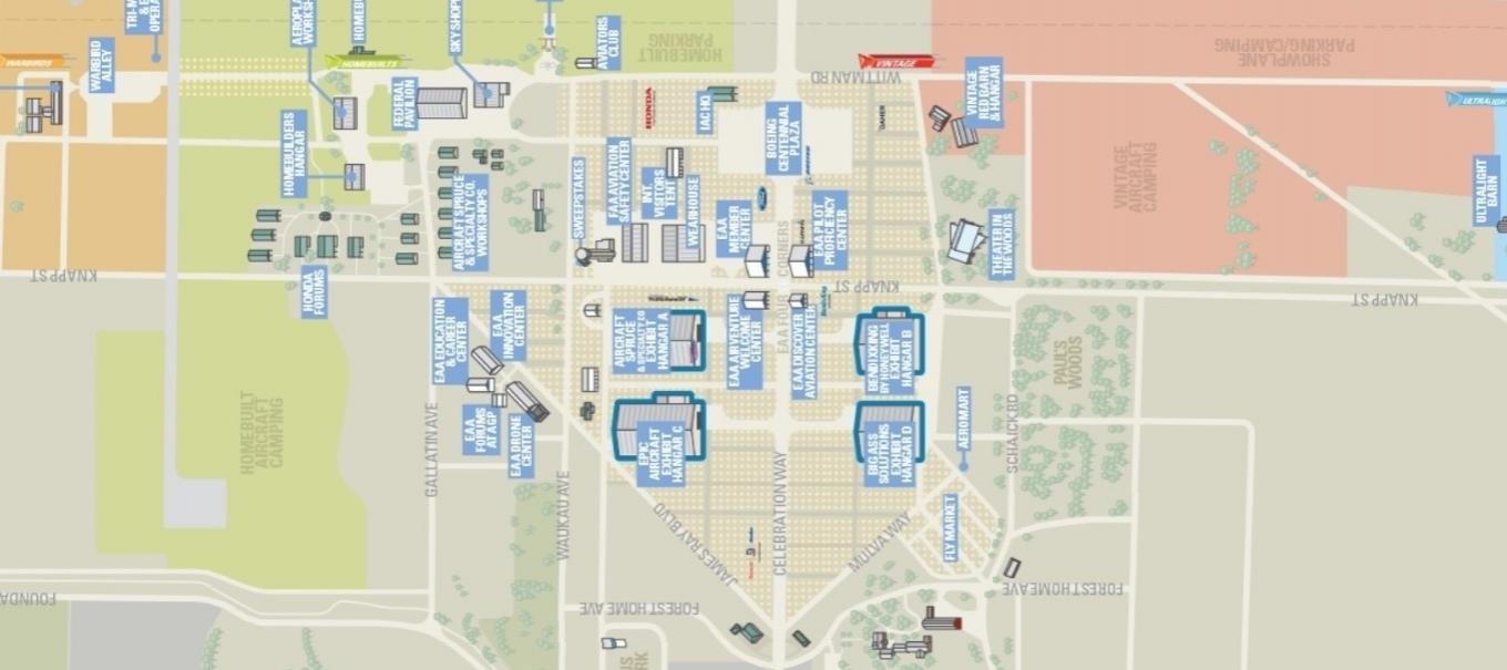
The map drawings that I uploaded depicts a more accurate scale of the actual road layout.
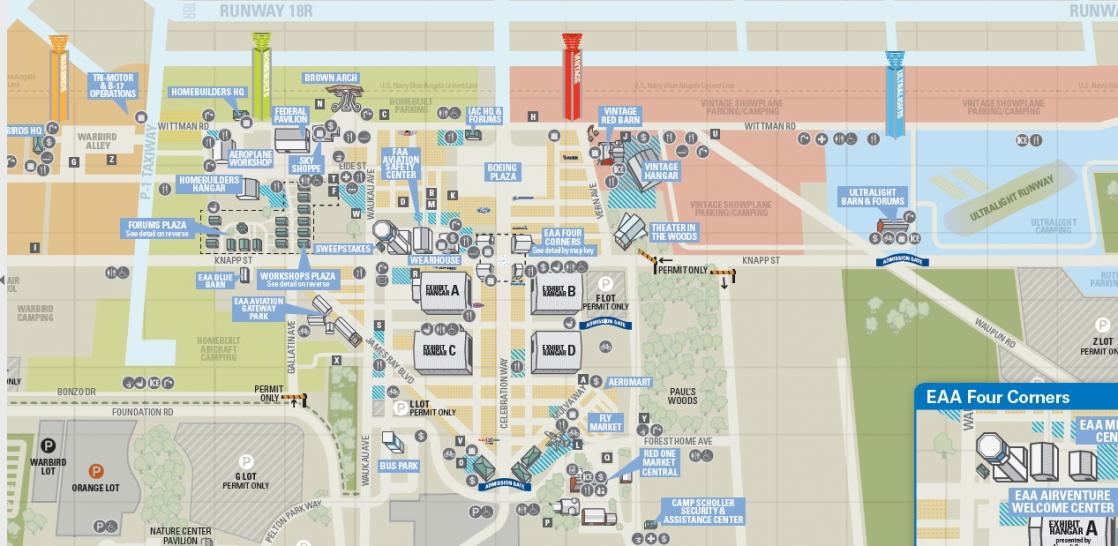
The regular AirVenture grounds map that is posted every year doesn't scale the road layout as accurately.
No big deal just wanted to help.
For an example:
Top map image: Regular AirVenture grounds map, Check the road to the right of Hangar B, this is not how the road is laid out.
Bottom map image: Map drawing that I uploaded, Check the road to the right of Hangar B, this is the actual road layout.
Maybe one of these days I'll make 3d scale model of the AirVenture grounds, like a model train layout.
Last edited by Wrongway Feldman; 07-16-2017 at 06:54 PM.
-
I actually have a google earth layer that has all the airplane parking row numbers on it. Me (Vintage) and Garret Nieven (FLS) put it together a couple of years ago.
 Posting Permissions
- You may not post new threads
- You may not post replies
- You may not post attachments
- You may not edit your posts
-
Forum Rules


 Reply With Quote