Results 1 to 7 of 7

Thread: Route-airport planner

  1. #1

    Route-airport planner

    Some years ago EAA had a long distance flight planner that allowed limitations on leg lengths, airport facilities and lengths, surface conditions and the like. I have been out of the country for a while and I am looking for such a planner to assist in long distance planning for animal rescue attempts. Could someone help me locate such a route planner again? Hopefully free.

    Mrbusybody
    KIDA

  2. #2

    Join Date
    Jul 2011
    Location
    Sidney, OH
    Posts
    444
    Check out NavMonster on Google for facility information...I use AOPA's flight planner for X-countries.

    Joe

  3. #3
    FlyingRon's Avatar
    Join Date
    Aug 2011
    Location
    NC26 (Catawba, NC)
    Posts
    2,629
    EAA had a deal with Aeroplanner.com. I used it for a while but now I pretty much use foreflight for most stuff. I get my weather stuff from www.weathermeister.com

  4. #4
    Sam Buchanan's Avatar
    Join Date
    Nov 2011
    Location
    KDCU
    Posts
    568
    Quote Originally Posted by Joe LaMantia View Post
    Check out NavMonster on Google for facility information...I use AOPA's flight planner for X-countries.

    Joe
    Unfortunately Navmonster is another victim of the FlightPrep debacle and has been gone for several months.............
    Sam Buchanan
    The RV Journal RV-6 build log
    Fokker D.VII semi-replica build log

  5. #5

    Join Date
    Jul 2011
    Location
    Sidney, OH
    Posts
    444
    Sam,

    Thanks for the "heads-up", I've been flying locals this fall so haven't had a need to look over a "new" destination. I'm looking to get a mini I-pad and pick-up either Wings-X or Foreflight before spring.

    Joe

  6. #6
    iflyprops's Avatar
    Join Date
    Jan 2013
    Location
    Atlanta, GA
    Posts
    5
    Quote Originally Posted by Mrbusybody View Post
    Some years ago EAA had a long distance flight planner that allowed limitations on leg lengths, airport facilities and lengths, surface conditions and the like. I have been out of the country for a while and I am looking for such a planner to assist in long distance planning for animal rescue attempts. Could someone help me locate such a route planner again? Hopefully free.

    Mrbusybody
    KIDA

    I use fltplan.com and when a fuel stop is necessary I plot the great circle route on http://www.gcmap.com/, throw some 'range' arcs up and figure something out.

  7. #7
    iflyprops's Avatar
    Join Date
    Jan 2013
    Location
    Atlanta, GA
    Posts
    5
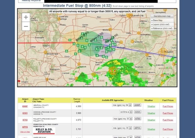
    I also just stumbled upon this fuel stop planner on fltplan.com. You input your route and how far (in distance and time) you would like to fly prior to stopping and voila, it populates airports and fuel prices. Here's a route that I put in for an upcoming trip I have where a fuel stop will be necessary going west:


Posting Permissions

  • You may not post new threads
  • You may not post replies
  • You may not post attachments
  • You may not edit your posts
  •